Highlighting the rising pedestrian deaths nationwide


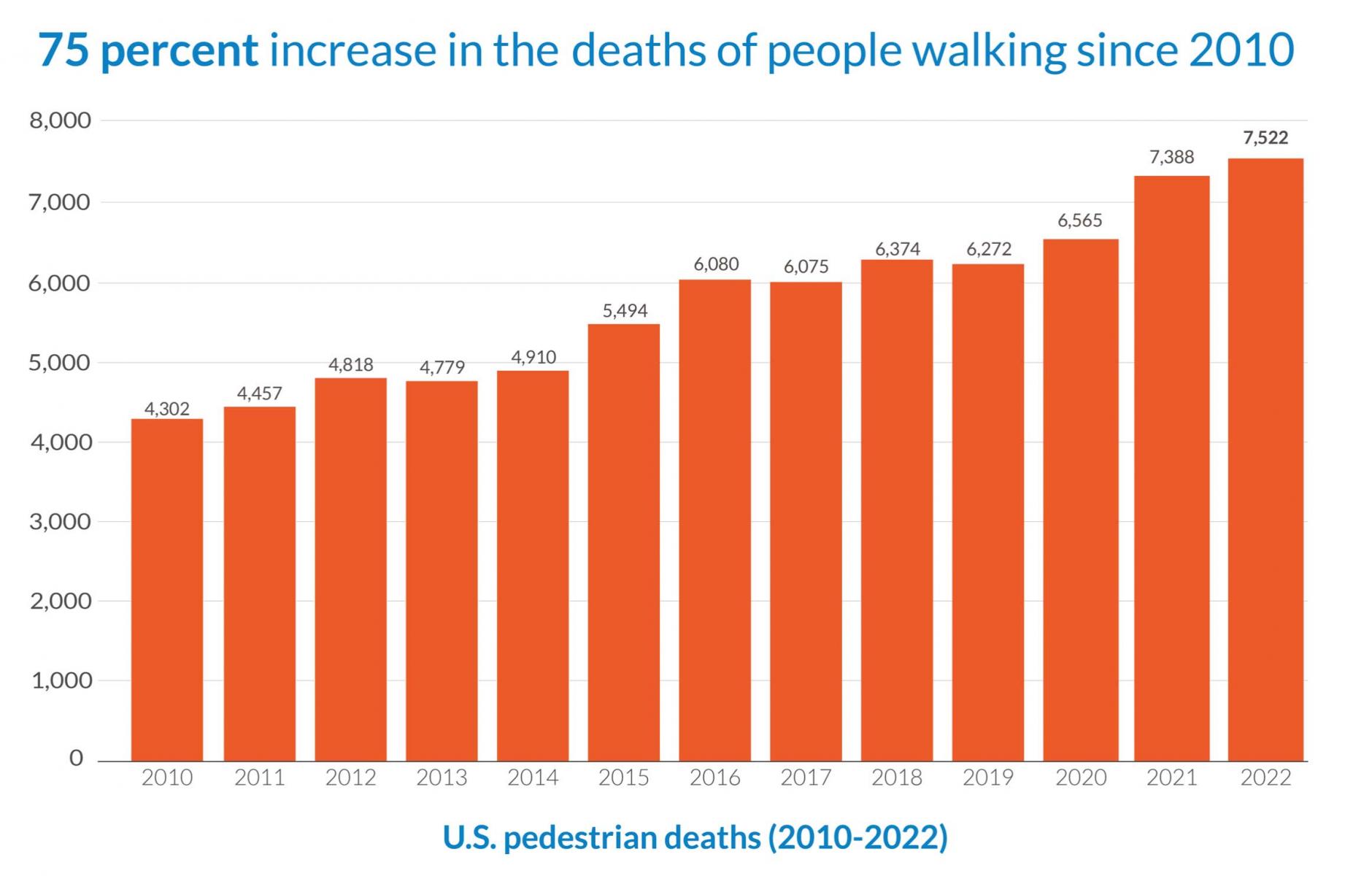
This week is a big one for the ongoing battle for safe, livable streets. The important book Killed by a Traffic Engineer was published, and Smart Growth America released its semi-annual Dangerous by Design report. US pedestrian deaths have risen 75 percent since 2010 (see chart above), and that number is at a 40-year high. The report compares the toll to three full Boeing 737s falling from the sky every month. Each fatality represents about 30 years of lost life, and each person “left behind a grieving family and friends.” For each fatality, 10 to 15 people are hospitalized, and many are left with lifelong debility.
It’s a gruesome topic, and many of the headlines emphasize the cities with the worst safety records: Memphis, Albuquerque, Tucson, Bakersfield, Deltona/Daytona Beach/Ormond Beach, Baton Rouge, Fresno, Tampa/St. Petersburg/Clearwater, Charleston/North Charleston, Little Rock/North Little Rock/Conway. But the real story is a national one, bigger than a race to the bottom.
All the worst regions, and for that matter, all of the worst 100, are well-supplied with massive arterial roadways built according to standard traffic engineering practice over the last six or seven decades.
Such thoroughfares form the “high-injury network” found in every metro area. Most cities run this analysis and find that 50 percent of serious injuries happen on only five percent of streets or 60 percent occur on 6 percent, explains Wes Marshall in Killed by a Traffic Engineer. “Every time, the map ends up highlighting the exact big roads where state departments of transportation have emphasized the conventional, capacity-based traffic engineering design approaches described here.” The combination of the three main design criteria—design capacity, design speed, and the design vehicle “has systematically led to the creation of the deadliest streets in most every city,” he explains.
Dangerous by Design has a nifty interactive map of all pedestrian deaths in the US over the last 15 years that allows you to zoom in on any metro area and trace most of the fatalities to thoroughfares designed for high speeds, even in places with pedestrians. The roads are set up so drivers often have to watch for two things simultaneously, such as merging traffic and pedestrians entering the roadway. Design speeds ensure that drivers cannot stop in time if they realize, too late, that a pedestrian is in the way.
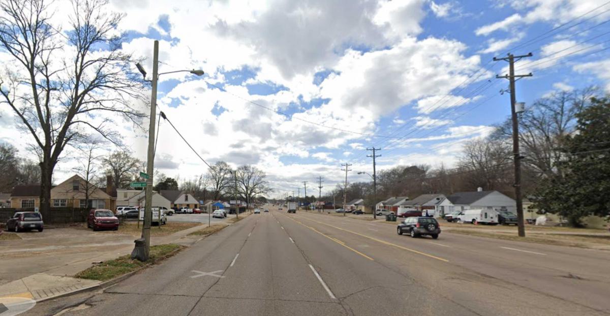
The top spot for the deadliest pedestrian region is the Memphis area, which has risen steadily in the rankings since 2009. The rate has tripled from 1.83 deaths to 5.14 deaths per 100,000 people. Above is a very dangerous arterial, Jackson Avenue, in Memphis. Note the massive roadway with six, 12-foot-wide travel lanes, plus a center turn lane, all designed according to standard practice. The presence of housing and commercial along the arterial ensures that people must walk to destinations, and the road is very dangerous to cross. Jackson Avenue does have a small sidewalk, but note the amount of infrastructure devoted to cars compared to pedestrians.
