How (lack of) streets contributed to the London tower tragedy
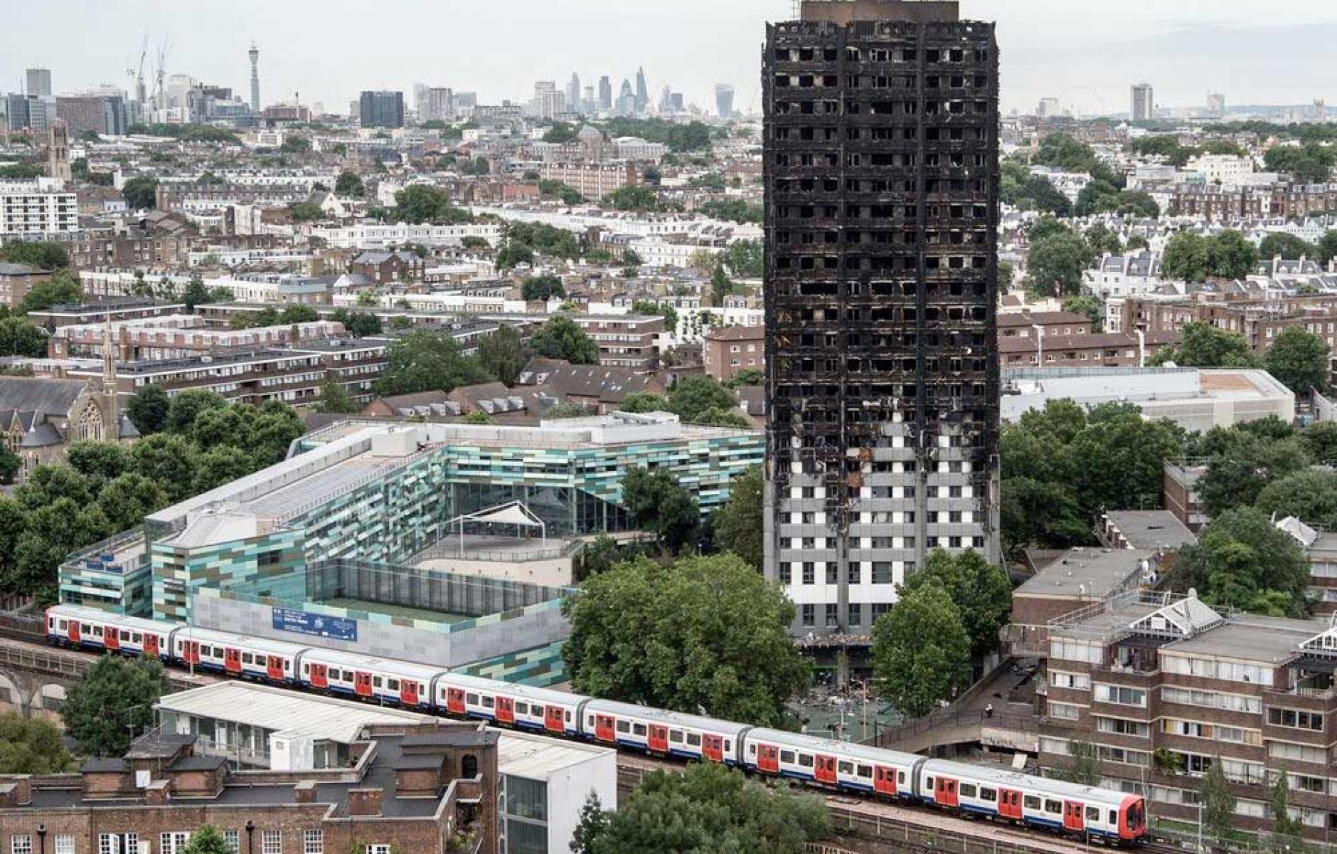
Did anyone notice how virtually all of the news images and videos of the recent fire disaster at Grenfell Tower in London were shot from some distance or from the air? There were no views from adjacent streets. This wasn’t just because of public-safety reasons, but something more fundamental: There are no adjacent streets. None.
In fact, one of the contributing factors in the unfolding disaster was that large fire engines had great difficulty getting right up beside the building and were therefore hampered in their efforts to save lives and douse the fire. This got me thinking: Why was this?
If you look at a Google Earth aerial photo of the area around Grenfell Tower, you will notice a striking feature. While surrounding areas have a fine-grained traditional street network, Grenfell Tower is at the centre of a large, amorphously shaped area that has no through streets. Bramley Road to the west, Silchester Road to the north, Walmer Road to the east and Treadgold Street to the south define the perimeter of a large swath of city in which streets dare not go. It’s as if the city planners somehow forgot to complete this part of London’s urban street network.
In fact, they didn’t forget. If you use the historical time-lapse button on Google Earth, you can see that there was indeed a local street network up to about 1945. The black-and-white photo is blurry, but the roads are clearly there. Through streets, short blocks, row houses and the like are all visible. Silchester Road continued into Clarendon Road and Lancaster Road continued southwest to Bramley Road.
What happened? It looks like part of the area may have been bombed in the war. More to the point, post-Second World War urban-planning orthodoxy declared its own war on urban streets, inspired by the likes of Le Corbusier. This new theory of urbanism saw cities demolish older compact areas or clear bomb rubble and replace it with a new form of (anti-) urbanism. Anne Power, British housing expert and London School of Economics professor, has spoken of the craving of architects and planners at the time for “something distinctive and prestigious.” Architects and planners even invented a vocabulary to justify what was in effect a sales pitch: They would build “vertical streets … villages in the sky … new cities for a new age …” and so on.
Lancaster West Housing Estate, of which Grenfell Tower was the centrepiece, was built according to these ideas, as part of the slum-clearances projects of the 1960s and ’70s. The estate stands on land previously occupied by several public streets: Blechynden Street, Blechynden Mews, Barandon Street, Hurstway, Testerton Street and so on.
These streets (and the row houses fronting them) were replaced with pathways, private driveways leading to underground parking garages, and housing complexes surrounded by greensward. Houses no longer faced a public street. Social consequences (and local residents, as it tragically turned out) were damned.
Staying in Google Earth, if you go into street view and move to the north end of where Grenfell Road peters out under a raised concrete superstructure, you’re in what can most charitably be described as the back-of-house service bowels of a dystopian piece of modernist architectural garbage. Peeking out from behind the garbage-bin lined concrete overhang is the entrance to Grenfell Tower: you’re on the closest street to its former and late residents’ front door. The contrast between this bleak environment and that of surrounding streets couldn’t be more jarring or brutal.
Writing recently about the Grenfell Tower fire in The Guardian, Simon Jenkins points out that, “I could not help noticing the charm of the surrounding streets, squares and precincts of North Kensington, of Avondale Park and Walmer Road. This is not smart Kensington: these … houses, mixed public and private, are built on streets, pleasing to look at, densely packed but low-rise. Each seemed a neighbourhood in itself, 100 miles from the (Grenfell Tower) horror that loomed overhead.”
As a student at the Architectural Association in London, I lived on one of those charming streets for several years, no more than four blocks from Grenfell Tower. Elgin Crescent is everything that Lancaster West Estate isn’t: a coherent, humanly scaled, intact and elegant piece of urbanism that, incredible as it may be to contemplate today, was itself a speculative housing development in its day (the Ladbroke Estate, developed in the mid-1800s and sold on long-term leases, and which now forms one of London’s most expensive and fashionable neighbourhoods).
Most importantly, all the attached terraced houses, which back onto communal garden squares, front directly onto the gently curving streets. It’s this elegant yet simple arrangement of private buildings facing public streets that created a real sense of community on my street. It’s precisely what Grenfell Tower lacked, and this dysfunctional, postwar, urban-spatial arrangement not only helped kill the housing estate’s sense of connection to the larger city, but many of its residents as well.
I confess that in all the years I lived next door, I never visited Lancaster West Estate. It felt disorienting, dangerous, physically disconnected from my little corner of London. It turns out that this sense of disconnection and danger was all too tragically real. We all need to learn the real urban-planning lessons from the Grenfell Tower disaster.
Streets matter, critically.
This article first appeared in the Vancouver Sun.


