Legacy Projects poised to make a difference


CNU’s 2024 Legacy Projects reports highlight the long-term potential and a wide range of solutions for the Cincinnati region, where the Congress was held in May of this year.
The Legacy Projects start about six months before the annual CNU Congress. They leverage CNU’s planning and design expertise to impact the host region in the long term. At CNU 32 in Cincinnati, CNU celebrated ten years of Legacy Projects, which have been implemented at a high rate over the last decade.
The four 2024 projects came to a head during local design sessions in February and March, and preliminary results were presented at CNU 32. Later, written reports enabled local officials to implement the plans, boosting connectivity, housing, walkability, and quality of life. This year, teams of national experts created plans for two small cities, a recently dissolved village with land returned to two townships, and a neighborhood in Cincinnati with a storied industrial history.
Final reports include the following projects:
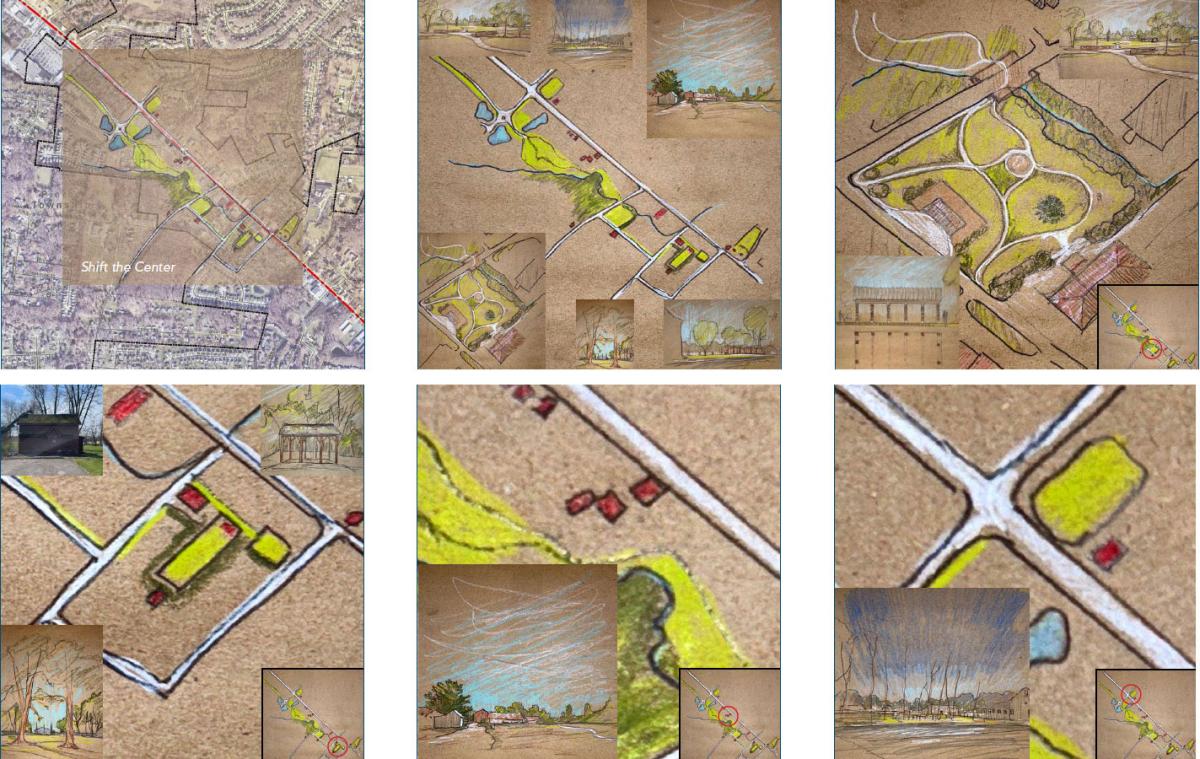
Hub District
The Hub District Vision and Implementation Plan is a strategic revitalization plan for an underutilized 70-acre area surrounding a former rail station turned bike and trail hub adjacent to downtown Xenia, Ohio. Xenia is located about 50 miles northeast of Cincinnati.
The report provides a road map to transform the district's infrastructure and opportunity sites. Many sites could accommodate missing middle housing, inventive commercial opportunities, and recreational elements currently needed in the city. Opticos Design led the project with J. Griffin Design, Zimmerman/Volk Associates, and support from CNU.
The Hub District has significant attributes:
- It sits at the nexus of four popular interstate trails that were once rail lines, including the Ohio-to-Erie Trail, Little Miami Scenic Trail, Xenia-Jamestown Connector, and the Creekside Trail.
- Xenia Station is a park with a replica of a 19th-century telegraph building that serves as an information center and comfort station for trail users.
- The District is just a 5-minute walk from downtown.
- Industrial and brownfield sites are scattered throughout and adjacent to the Hub District—many are available for adaptive reuse.
- Neighborhoods rich in historic residential buildings surround the district.
- The Market District development at the north end of downtown has a symbiotic relationship with the Hub District; together, they will attract residents and commercial activity to downtown.
Three goals are established for the Hub District:
- Transform the Hub District into a thriving mixed-use neighborhood.
- Leverage the existing and future assets.
- Create a community-based cohesive vision that guides and inspires future implementation.
The district was the subject of a market study showing the capacity to absorb 114 to 154 residential units annually for five years. Still, zoning reform is needed to allow for this development.
The report outlined how implementation could be phased, starting with quick, low-cost connections of district anchors and surrounding neighborhoods within a year. Following that, catalytic development could be encouraged in two to five years. Finally, an expansion of the park and new housing opportunities could come in the next 15 to 20 years.
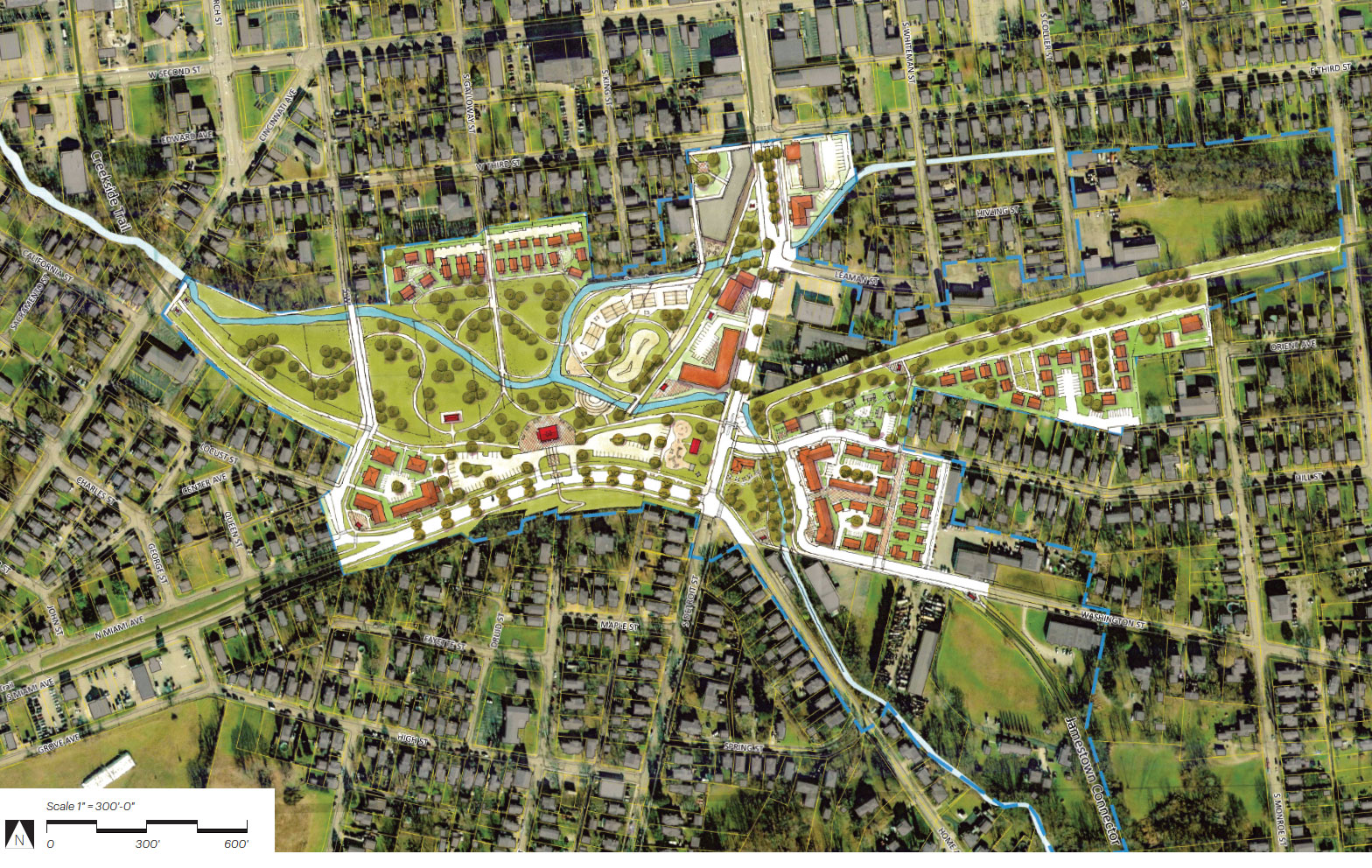
Connect Norwood
Connect Norwood is a vision to overcome barriers and connect neighborhoods in Norwood, Ohio, a small city surrounded the larger city of Cincinnati. The report focuses on corridors, intersections, crossings, and gateways that promote walkability, bikeability, and environmental sustainability. Cities that promoted human-scale planning and development tend to do better economically, according to Stantec’s Urban Places, which led the Legacy Project.
Connect Norwood aligns with Norwood’s long-term goals of fostering connectivity and promoting healthy lifestyles, notes Mayor Victor Schneider, in a letter that introduces the report. “By connecting key destinations such as schools, parks, shopping areas, and public transportation hubs, we can create a more cohesive and accessible city for all residents.”
The report identifies and prioritizes 31 projects enabling the city to achieve its goals. The city could move these forward through state, federal, and private funding sources.
“Federal funds are well suited to higher cost infrastructure projects,” notes the plan. “Improvements that involve mainly paint, such as shared lane markings, could be implemented through routine maintenance, set-aside funds, or grouped as one federal funding application.
Pike with a Purpose
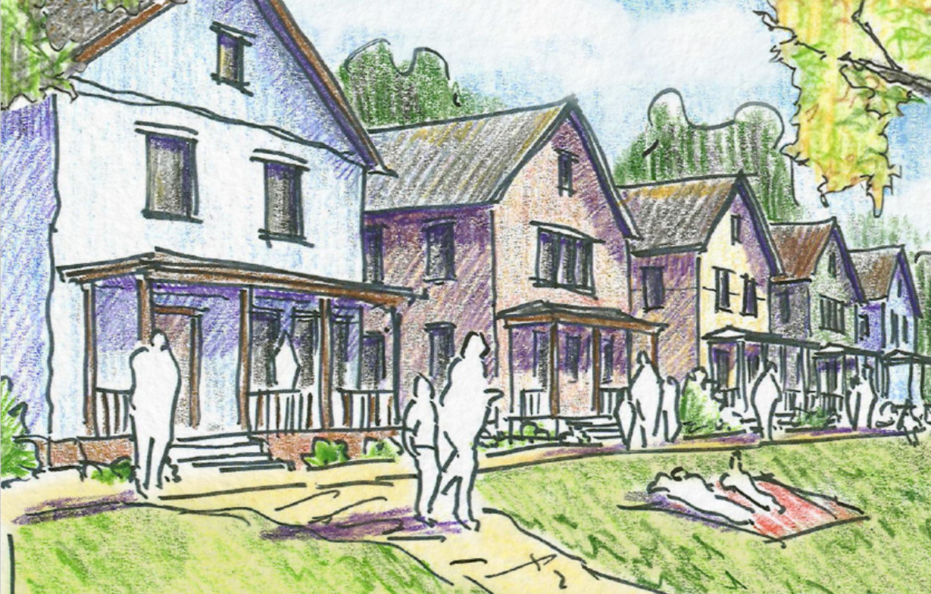
The CNU-sponsored team led a design session with Batavia and Pierce townships in Ohio to reimagine the future of Amelia. This village was dissolved as a municipality in 2019 and incorporated into the two jurisdictions. In the middle is the Ohio Pike, an automobile-dominated arterial road that is difficult to navigate on foot and offers little sense of place.
The consultant team of ZoneCo and designer/illustrator David Pearson led a three-day event attended by more than 100 residents. The goal is to make the area a place to “linger and live, rather than pass through.” Accomplishing that “required the center of activity to be removed from Ohio Pike,” according to the report.
The Ohio Pike runs the length of the study area—about 1.5 miles. On or near the Pike are a series of amenities, including a regional library, elementary school, post office, large grocery store, public green spaces, and natural features.
“As the team walked the study area, we discovered that the most pleasant and, in many cases direct path between these amenities was not on Ohio Pike, but rather along a green pathway a few hundred feet to the south of Ohio Pike,” the report states. Therefore, the team drew a new route to connect these assets—that could be highlighted and improved by public investment. The route would include two existing crossings the Pike.
Pike with a Purpose reverses the usual emphasis of new urban plans, which focus on new and revitalized buildings that frame public spaces and streets. Instead, this plan leans into green spaces and a path.
“After walking the study area and talking with stakeholders, it is apparent that leading with the built environment is not the best first approach. Rather, leading with green spaces and ways to create an amenity-rich, safe, pleasant, pedestrian-friendly environment will lead to increased demand and would have the best chance of creating the economic environment that would allow for the type of development that the townships desire,” the report states.
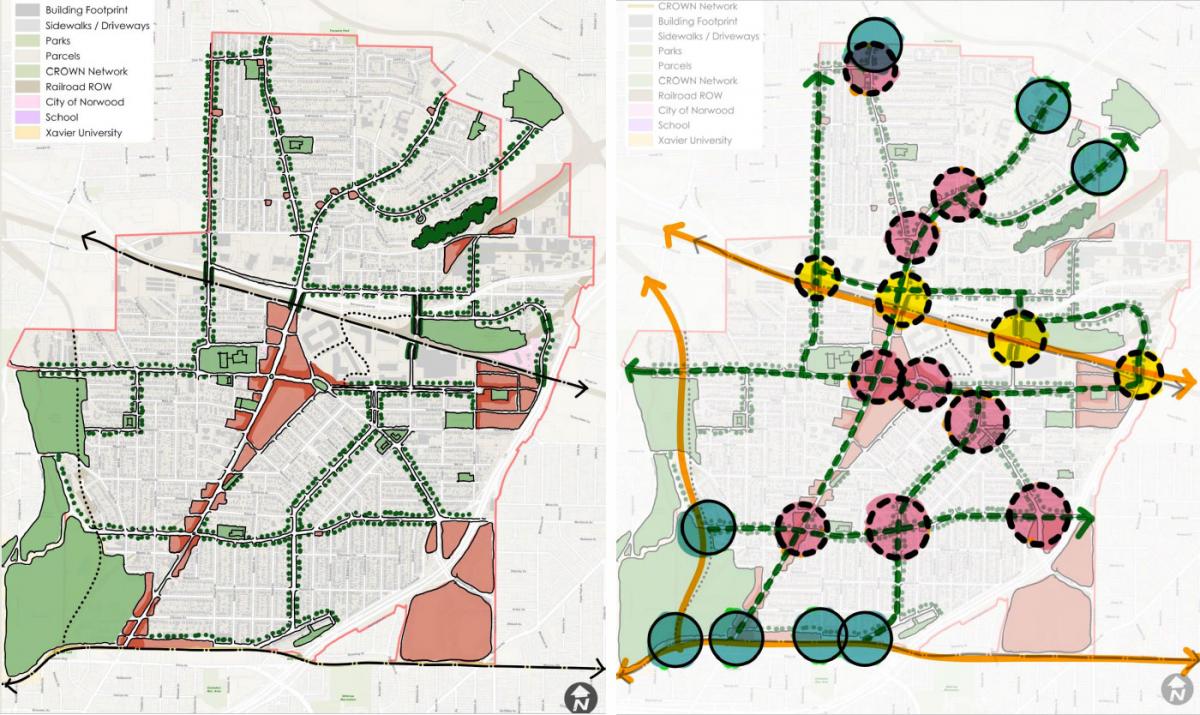
Camp Washington
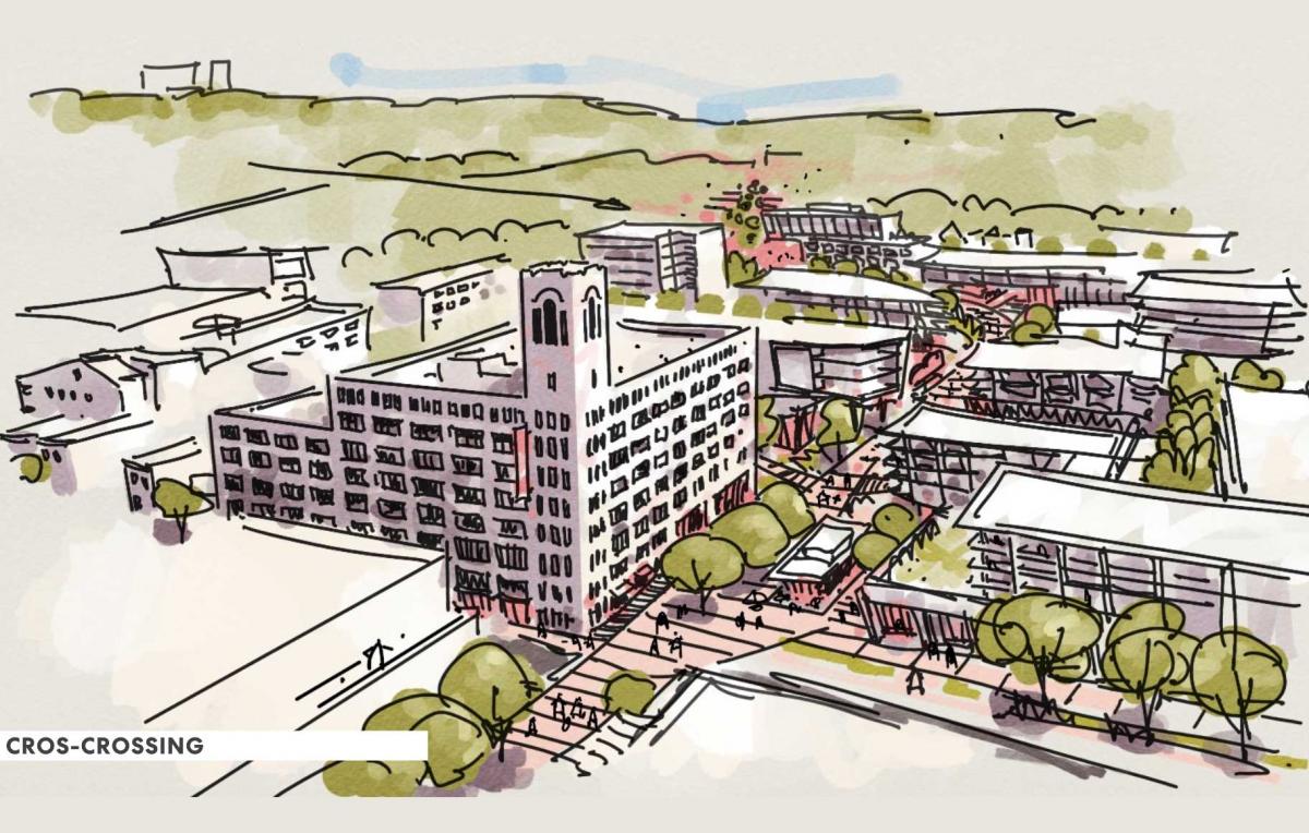
The Camp Washington report is still in the works, but it will address how to manage growth in an artistic, quirky, industrial neighborhood about two miles northwest of downtown Cincinnati. Camp Washington has been decimated by population loss over 50 years and has tremendous potential for new growth:
- Camp Washington has room for substantial new development, including vacant lots throughout the neighborhood and large industrial parcels unsuited for industrial redevelopment.
- Many industrial buildings are available for reuse, including Cincinnati’s landmark Crosley Building, an eight-story structure with a highly visible tower.
- The team analyzed a makeover for Valley Park, a square that could become the central gathering space for the neighborhood.
- Camp Washington’s fine main street, Colerain Avenue, could accommodate substantial redevelopment of underutilized parcels.
- Flexibility and adaptability are needed to keep artists and related culture rooted in the neighborhood. To that end, local businesses rather than chain stores should be promoted.
- The neighborhood needs strategic improvements to the public realm that will improve access and walkability.
- Camp Washington needs zoning reform to foster density and a built form to make the neighborhood thrive.
- The 34-mile CROWN (Cincinnati Riding and Walking Network) is under construction, and Camp Washington can benefit by adding links and trails.
