Model for suburban retrofit in the Inland Empire
Some experts predict the major development trend in the next 20 years will be “urbanizing the suburbs,” bringing density and mixed-use to underutilized commercial areas. If so, the Inland Empire of Southern California, with 4.6 million people, could be a test case.
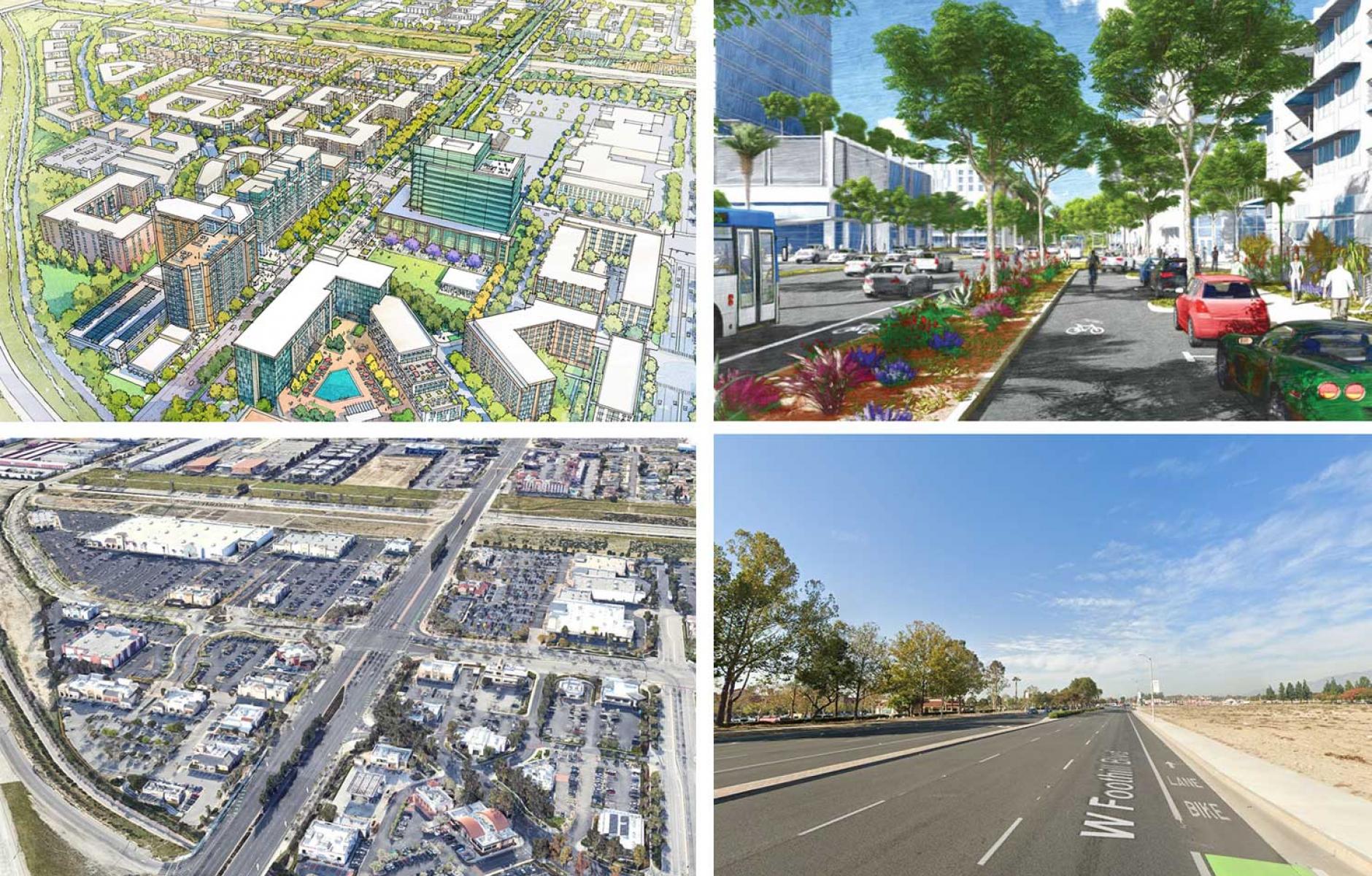
Rancho Cucamonga, an important city in the Inland Empire, has an ambitious suburban retrofit plan showing massive transformation potential. The General Plan by Sargent Town Planning, which updated the city’s 1980 plan, involved a large public outreach effort for residents and stakeholders—mostly virtual because it occurred during the pandemic.
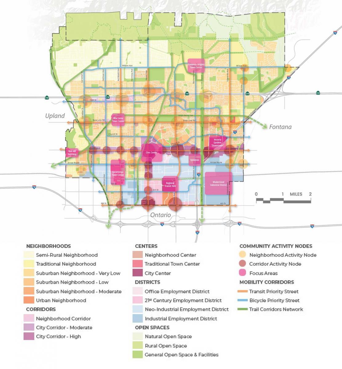
The suburban City of 175,000 people grew out of three small agricultural communities overrun by sprawl in the last 50 years. The Rancho Cucamonga plan shows what may happen in many large suburbs—vast single-family residential areas will likely see limited infill. At the same time, most urbanizing occurs along corridors and at key urban centers.
“The Preferred Alternative concentrated transformational change around the City’s major central corridors, existing regional lifestyle mall, and Metrolink station, with limited incremental change in established single-family neighborhoods,” according to the planners. The transformation is guided by new urban “Place types,” including City Center Corridor, City Center District, Urban Neighborhood, Traditional Neighborhood, 21st Century Employment District, and Neo-Industrial Employment District.

Special urban design attention was given to eight “focus area plans” where more immediate development is expected, particularly along two major transit boulevards. “The City has received significant grant funding and established a tax increment financing district for City Center infrastructure and a TDM (transportation demand management) program,” Sargent says.
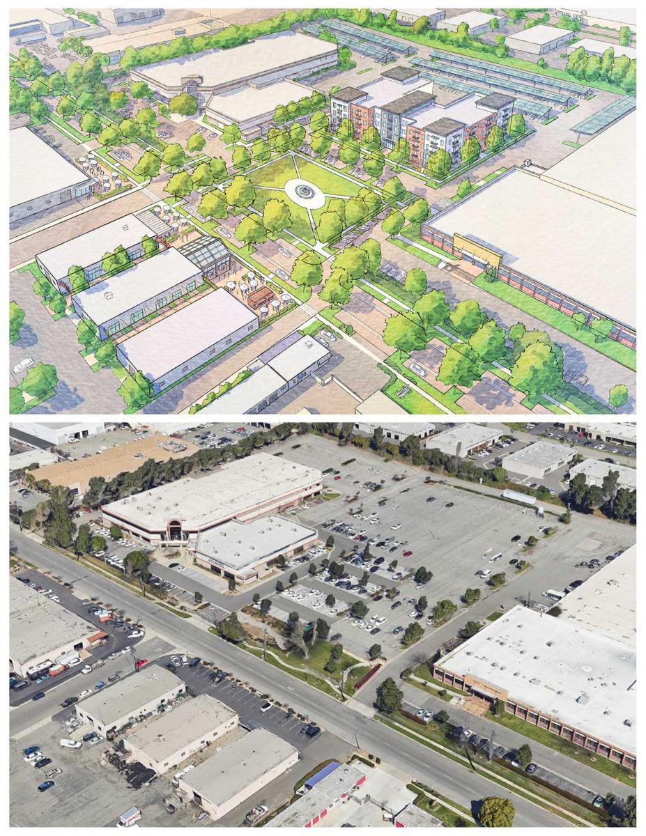
Also, a form-based code was adopted. The General Plan provides a toolkit of development options to help bridge the gap between developers used to the current system and the new regulations. This sprawl repair toolkit “illustrates step-by-step strategies for rebalancing the public realm in favor of pedestrians, activating frontages, and extending a safe, human-scale public realm and walkable block structure into large vacant and previously developed parcels.”
Justine Garcia, Deputy Director of Engineering Services, explains what’s next: “Some of the things we will be working on through the implementation of our General Plan are improvements to our trail network, improvements to our sidewalk network, increasing transit opportunities and options for everyone within our city. Our built environment is changing, and we want to make sure we are providing connectivity in the sense of neighborhoods in order for people to be able to reach all of the things they need in a close range and without getting in a vehicle.”

The plan has a 20-year horizon but sets a framework for development over the next 100 years, the planners note.


