Dissolving border vacuums, Part 2


At-Grade Border Vacuums: Arterial Roads
In the last post on at-grade border vacuums we discussed solutions for vacant lots and parking lots, so this time we'll examine solutions for arterial roads. Over the coming months we'll examine solutions for many other kinds of border vacuums and see if they could apply to Baltimore.
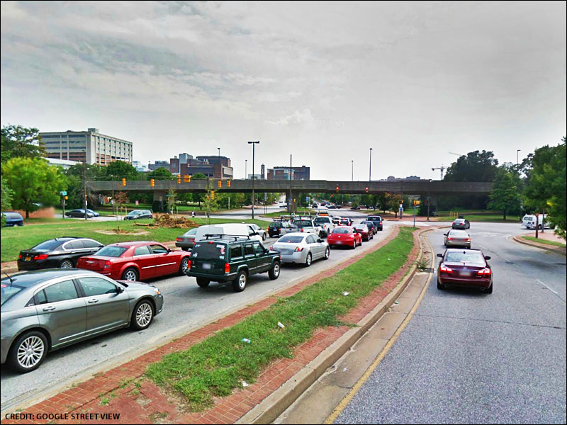 |
Despite its misleading name, MLK Boulevard is a repellent arterial. |
The Dilemma of Through Traffic
After WWII the arterial road became the common solution for accommodating urban through traffic. Unfortunately arterials devolve into formidable border vacuums that interrupt the continuity of urban fabric – they're essentially an inappropriate solution for urban areas. Baltimore has many notorious examples that seem to frustrate everyone, whether they're pedestrians, cyclists, drivers, transit riders, or nearby residents and businesses: President Street, Pratt Street, Russell Street, MLK Boulevard, and large portions of North Avenue, Mt. Royal Avenue, Howard Street, Light Street, Dolphin Street, Fayette Street, the list goes on and on.
Is there a way for thoroughfares to accommodate through traffic without turning into border vacuums? In this post I'll posit that some of the above arterials might be better urban neighbors if they were rebuilt as center-median or multiway boulevards. But before we discuss the specifics of these two kinds of boulevards, let's look at some more modest prerequisite solutions first:
Signal Timing
Pedestrians, cyclists, and drivers have all experienced the frustration of long waits at certain crosswalks/traffic lights. I've noticed that I tend to avoid crossing arterials with long waits unless I have no choice: why suffer the difficulty and unpleasantness of an arduous crossing expedition? Poor signal timing (long green-yellow-red cycles between the “walk” signals) tends to exacerbate the border vacuum effect of arterials by making it too arduous to cross them on a casual basis. So pedestrians either resort to jaywalking or gradually stop crossing the arterials, which only solidifies their border vacuum effect.
Therefore one easy, but limited, strategy to dissolve the vacuum side effect of an arterial is to adjust its signal timing to shorter cycles, possibly 60 seconds or less. This reduces waiting time for pedestrians, thus allowing them to cross more easily and frequently.
Although this strategy is quite useful in encouraging pedestrians to cross arterials that already have adjacent pedestrian activity, like Pratt Street, it can't induce pedestrian life in and of itself, particularly if there's nothing worth crossing for/walking to! For example, improved signal timing would do little to reduce the vacuum side effect of MLK Boulevard. To create something worth walking to, you'd have to build the mixed-use infill we discussed in the previous post!
 |
Enclosing arterials with buildings can make them feel narrower. |
Sense of Enclosure
Another subtle strategy to reduce the vacuum side effect of an arterial is to enclose it with infill buildings tall enough to make the arterial feel narrower than it actually is. So the wider the arterial, the taller the enclosing buildings would need to be. In the photo on the left, you'll notice that the arterials in both scenes are of comparable size, but that the first one feels more intimate because it was enclosed with buildings that form a “street wall.” While a comfortable height-to-width ratio of enclosure – the height of the enclosing buildings in proportion to the width of the arterial they're on – can vary, it seems that a 1:1 ratio feels best (see page 45) for mixed-use thoroughfares and that even more intimate ratios, like 3:1, are possible for residential streets.
If it's not possible to provide enough (or tall enough) infill to offer a sense of enclosure, street trees can be used instead. It's best to use hardy species that can form canopies quickly. Unfortunately sometimes dinky ornamental species are used – akin to the fillers in supermarket parking lots – and these don't offer a sense of enclosure at all. Street trees aren't just supposed to be decorative; they need to enclose arterials just like buildings would.
Reconnecting and Rightsizing
It's possible to (re)introduce cross streets to arterials to enable pedestrians and cyclists to cross them in more places. This strategy also breaks up superblocks into smaller blocks that are more conducive to street life, as Jane Jacobs discussed in Chapter 9 of The Death and Life of Great American Cities. In fact, there already are proposals for doing exactly this to a portion of MLK.
Arterials can also be “rightsized." This involves the narrowing and/or removal of lanes (like downsizing to 10-foot travel lanes and 8-foot parking lanes) and repurposing the reclaimed space for bike lanes, bus lanes, street trees, and/or wider sidewalks. So, for example, if State Center was redeveloped (we'll get to that proposal in a future post!), there's no reason why the maze of arterials in that area (Howard, MLK, Preston, Dolphin, etc.) couldn't be substantially downsized.
The Difference Between a Boulevard and an Arterial
As Allan Jacobs notes in The Boulevard Book, a boulevard is essentially mixed-use, whereas an arterial is single-use: “The boulevard directly addresses the problems posed by the coexistence of through traffic and access to abutting land uses on major urban thoroughfares. It allows these seemingly contradictory but often complementary needs to coexist in the same corridor. Analogous to mixed land uses – another victim of planning and development procedures since WWII – the boulevard is a mixed-use public way that is by its very nature complex (5-6).”
Just as we inappropriately imported alien development patterns into cities (single-use zoning), Jacobs argues, so too did we import alien transportation patterns (single-use arterials) into cities. In the last few decades we've reacquainted ourselves with mixed-use urban infill, so perhaps now we should reacquaint ourselves with mixed-use transportation corridors like boulevards.
 |
Drawing of a center-median boulevard (Unter den Linden) by Allan Jacobs. |
Center-Median Boulevards
Center-median boulevards have – you guessed it – a median running down their center! Depending on its width, the median can accommodate a simple row of trees, a transit line, or even a promenade/park – Eutaw Place and Broadway, albeit being badly butchered after WWII, are good examples of the latter. The carriageways on either side of the median are usually divided into two travel lanes and one or two parking lanes in each direction.
I think North Avenue, particularly the section from Pennsylvania Avenue to Greenmount Cemetery, could benefit from a center-median configuration, and indeed there are several suggestions for doing just that. While the proposals vary in their particulars, they share some crucial features: the (re)introduction of curbside parking to buffer pedestrians from traffic, the enlargement of the currently-useless shrubbery median into a fully-programmed promenade/park/square, and the downsizing and/or elimination of superfluous travel lanes.
However, we should never underestimate just how unpleasant it is for pedestrians to be near heavy traffic. Boston's Rose Kennedy Greenway is a case in point: the city shot itself in the foot by sandwiching prime urban land in the middle of a new arterial. Even though much of it is 100 to 200 feet wide, Boston's “glorified median strip” still can't overcome the unpleasant traffic on both sides. Lesson number one: people need more than meaningless “open space” to enjoy a median, and to its credit Boston is adding programming to the Greenway to distract people from the surrounding traffic. So I think a North Avenue median park would likewise need to be intensely programmed with activities to be successful.
Secondly, rather than waiting for saplings to mature to establish a protective screen, the median park would probably need to be lined with substantial trees from the beginning. (Note that this is exactly what's proposed for the renovation of Mt. Vernon Place.) Simply relying on elegant furnishings probably wouldn't be enough – although Eutaw Place and O'Donnell Square have just that, they feel nicer because they don't have nearly the same traffic as North Avenue.
Finally, a median park would need to be coordinated with infill that offered the sense of enclosure discussed earlier. So, for example, Madison Park North would need to be replaced with traditional fabric. The northern edge of Bolton Hill, having turned its back on North Avenue, would also need to be infilled: Spicer's Run would need to be wrapped around North, and the exposed railroad tunnel at Mt. Royal Avenue would need to be capped and infilled, along with the parking lot immediately to the west. The numerous “missing teeth” along the avenue in Station North (particularly the parking lots around the BCPSS HQ) would need to be infilled as well.
 |
Compare this old photo of Eutaw Place to the same area today! |
Existing center-median boulevards can also be improved with better infill. For example, there are plans to replace Eutaw Place's Pedestal Gardens and Bolton Hill Shopping Center with traditional infill akin to Spicer's Run (which did a good job reconnecting to Eutaw if not to North). To further dissolve Eutaw's vacuum effect, the proposal might also consider downsizing McMehen Street and incorporating corner stores (to further encourage pedestrian crossing). Of course, replacing missing trees, statues, benches, fountains, gardens, pavilions, and pavements would breathe life back into Eutaw Place as well.
 |
Drawing of a multiway boulevard (Avenue Montaigne) by Allan Jacobs |
Multiway Boulevards
Unlike center-median boulevards, multiway boulevards separate through traffic from local traffic and use the latter to extend the pedestrian realm and buffer it from the through traffic. A multiway boulevard thus contains three carriageways: a central carriageway for through traffic (usually two lanes in each direction, plus transit lanes if there's room) separated from two access lanes (one on each side) by tree-lined medians.
As Allan Jacobs notes, the access lanes must be built for low speeds – one 7'-10' travel lane and one or two 6'-8' parking lanes – to form a comfortable pedestrian realm: “The main feature that makes multiway boulevards safe and livable is the extent to which a clear pedestrian realm emerges between the buildings and the medians. This realm is structured as a complex area where cars are allowed but pedestrians dominate. The multiway boulevard allows access movements, through movements, and pedestrian comfort to coexist on the same street; it retains both traditional uses of the street – as a movement channel and a meeting place – without having to specialize in either one (111).”
By concentrating through traffic in a relatively narrow core (four travel lanes @ ~40-45 feet) and extending the pedestrian realm across the access lanes and medians, a multiway boulevard reduces the vacuum effect of an arterial by subtly downsizing it to the same dimensions as the average urban street (two travel lanes and two parking lanes @ ~40-45 feet), which allows for better signal timing (shorter cycles) and frequent pedestrian crossing.
Earlier we discussed how enclosing arterials with buildings could make them feel narrower. However, there's a caveat: just as pedestrians avoid walking along arterials, so too do buildings tend to shirk them. This is why the neighborhoods along MLK have all turned their backs on it via shrubbery buffers, berms, and walls, and why buildings along older thoroughfares that were turned into arterials (like North Avenue) fall into a downward spiral of dereliction. By serving as a buffer from through traffic, a center-median boulevard's parking lanes can create a pleasant enough environment for pedestrians and abutting buildings, but, as Allan Jacobs discussed, a multiway boulevard's access lanes and medians do an even better job at this. The short access lane and park median on the southwest side of Mt. Royal Avenue in Bolton Hill is a good example, though the avenue itself leaves much to be desired.
Therefore, I think MLK should be converted into a multiway boulevard (four central travel lanes flanked by access lanes with parking) so it could attract pedestrians and abutting infill, thus stitching West Baltimore back to downtown by functioning as a “seam.”
Next time we'll examine solutions for sunken borders (like highway and railroad ditches), so stay tuned!
This piece originally appeared in the EnvisionBaltimore blog.
For more in-depth coverage:
• Subscribe to Better! Cities & Towns to read all of the articles (print+online) on implementation of greener, stronger, cities and towns.
• Get the January-February 2012 issue. Topics: Made for Walking, walking audits, Takin' it to the streets, Queens development weathers Sandy, Shared space taken to a new level, Streetscape spurs downtown turnaround, Florida streets manual gets traditional neighborhood chapter, Is better parking lot design enough?, Cities in small metros growing, Redesign arterial streets for pedestrians.
• Get New Urbanism: Best Practices Guide, packed with more than 800 informative photos, plans, tables, and other illustrations, this book is the best single guide to implementing better cities and towns.