Great idea: Light Imprint for walkable green infrastructure
In celebration of the 25th Congress for the New Urbanism, Public Square is running the series 25 Great Ideas of the New Urbanism. These ideas have been shaped by new urbanists and continue to influence cities, towns, and suburbs. The series is meant to inspire and challenge those working toward complete communities in the next quarter century.
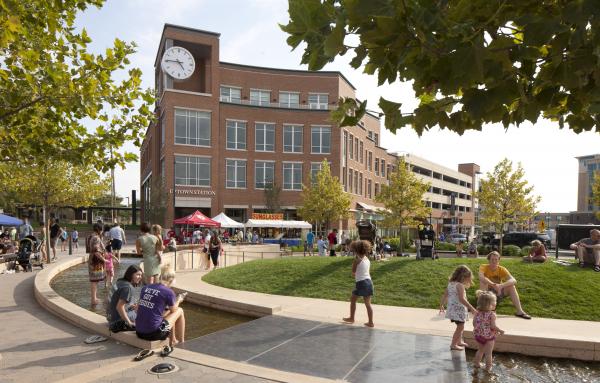
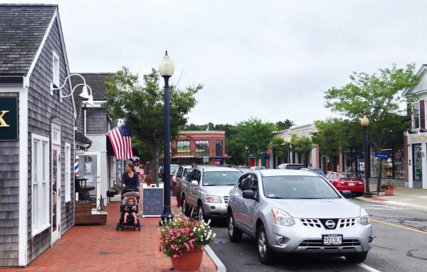
In the public realm, the greenery to impervious pavement ratio—and how that relates to urban context—has an impact on quality of life and experience. Conventional suburban design tends toward heavy use of asphalt, with wide roads lined by parking lots, in relatively low-density areas. This engineering approach requires large and expensive stormwater mitigation. New urbanists have countered with techniques that lay far lighter on the land, an approach that could be called "Light Imprint," "lean," or simply "green infrastructure." This light approach to engineering the land, combined with good urban design, makes for appealing streets and public spaces while providing effective rainwater management.
Public Square editor Robert Steuteville interviewed architect and planner Tom Low, founder of Civic By Design and author of the influential Light Imprint Handbook, and Paul Crabtree of the Crabtree Group, a specialist in civil engineering for urban places, on the the subject of Light Imprint and green infrastructure.

There's a lot of confusion around the term "green infrastructure." Some people think of Landscape Urbanism or maybe they think of rain boxes that you put out on the street. What is Light Imprint and how it is different from conventional stormwater management techniques?
Crabtree: It starts with the history of low-impact development (LID). Practitioners started treating stormwater separately from pipe and waste water and it was some groundbreaking work but it was done on the sprawl paradigm. In terms of best management practices, all the exemplars came from suburbia, like patches of mall parking lots or power centers or the implementation of rain gardens in every single front yard. These were engineering solutions that worked to distribute stormwater but they had no concept of good urban form. Light Imprint was one of the first responses to address the relationship between stormwater management and urban form.
Low: The LID movement was embraced as the standard by the EPA and civil engineering community at the turn of the century. Meanwhile, we had jump started a lot of New Urban projects, and many places had embraced the practices of traditional neighborhood development (TND). When the same forward-thinking developers and municipalities decided to embrace low-impact development, everyone assumed that it was going to be a good fit with New Urban projects. However, I started receiving phone calls from developers and municipalities that expressed complications with the integration of LID into walkable communities. It turned out it wasn't the great marriage that we all thought. They were imposing suburban standards on top of the TNDs and New Urbanism principles, and it wasn't a good fit. For example, the practice of installing a rain garden in the front setback of every house to mitigate stormwater. That means that every house is either 25 or 30 feet removed from the sidewalk and all of sudden the walkability and sociability factors that are important, the compactness, the connectivity, are all gone. We had to come up with a solution that modified and amended a lot of tools from LID, but we made them more functional for New Urbanism.
There was a Rainwater Initiative for CNU. How did it fit into all of this?
Crabtree: There was maybe four or five of us that started a task force in 2009 to provide input on the LID regulations that the EPA was developing. Around that time, we began the Rainwater Initiative, as well as the Rainwater-in-Context listserv, and we began having several sessions at every CNU to address it. That's where we came up with the tenets of the Rainwater Initiative that are on the website now.
Low: At the Philadelphia 2007 Congress, we launched the Light Imprint Initiative. Our workshop at this Congress was standing room only, because a lot of people, we found out, were dealing with the same issues. That was the moment when we found out that this was very important.
The tools that you're advocating here, how did they differ from LID or the more conventional approach?
Crabtree: Settlement patterns matter. Our tools address all scales from the site to the watershed, not just the site. They look at per acre impacts as well as per capita impacts. They use hydrology science, not arbitrary one-size fits all regulations. Those were all things that were not incorporated into LID.
Low: The Light Imprint Initiative was trying to figure out a way for New Urbanists to plug into low-impact development. These were two different cultures that existed and were running parallel, but they were clearly related. A lot of New Urbanists were doing beautiful place-based design, but the engineering was only an afterthought. And in many cases, the engineering worked against everything that was intended. Light Imprint approaches green infrastructure as part of an aesthetic, but also incorporates engineering from the beginning so down the road things don’t backfire. Three things have compelled people to consider Light Imprint and move forward with it. First, it is a more sustainable approach to New Urbanism in terms of dealing with water infrastructure. Second, if it's designed well, it becomes a more appealing place to live, especially to people who are interested in living in these types of communities. And third, which was a shock to most people, including us, when we started to analyze some of the case studies, they turned out to be more economical. Less expensive, better performance, and more appealing. This is a win-win-win scenario that really makes the idea compelling.
That's a good segue because there are lessons from history here. Back in the day, a century ago, there were fewer civil engineering rules, but there was also a thriftiness and a frugality to the built environment. You also see that at Seaside, Florida, to a degree. But what can we learn from the historic public works in terms efficiency and water recharge?
Crabtree: You mentioned Seaside, and it was Light Imprint without really even knowing or intending it. For example, they didn't mass grade the site. They didn't pave all the streets in the first round. The rainwater was falling and infiltrating where it landed. The Amphitheatre tended to handle the really large rainfall, and it was all done very lightly.
Low: It created a very beautiful civic space and mitigated the stormwater, and they combined the two in the same design.

Crabtree: They weren't even thinking much about rainwater. They were more thinking about lean infrastructure and implemented it gradually. In other words, when you only have a few homes, sand streets are fine. As part of a successional process, when more and more people get there and the density become greater, then you can start to harden things up. But even then, it was done with pervious pavers and what we now call bioswales.
Does the lean approach naturally lead to dealing with rainwater in an efficient way?
Crabtree: It does because the pipes and inlets are very expensive. The more you do naturally, the less pipes and inlets you use. It's less expensive and it looks better.
Low: I spent the last several years going around documenting historic and new places and I always look for these tools, because you can find them all over the place. Many places were created when there was a scarcity of resources or funds. Developers that are frugal to begin with can apply these techniques, and as they think them through, they can create great places. You don't have to use heavy equipment. When we came up with a whole series of tools, we weren't really thinking about costs or whether they were performing any better than simple approaches. But as we developed Light Imprint, we started to question whether LID products and other high-tech solutions worked better than traditional approaches that dealt with rainwater by design. For the most part, there was a lot of overcompensation going on.

Let's talk specifics. We talked about how the LID approach of putting a rain garden in front of a house and then you have to set the house back 25 feet, all of a sudden it becomes suburban. But you talked about Seaside, no mass grading, they didn't pave all the streets. What are the other things that are effective alternatives to these expensive, sometimes inefficient, LID techniques?
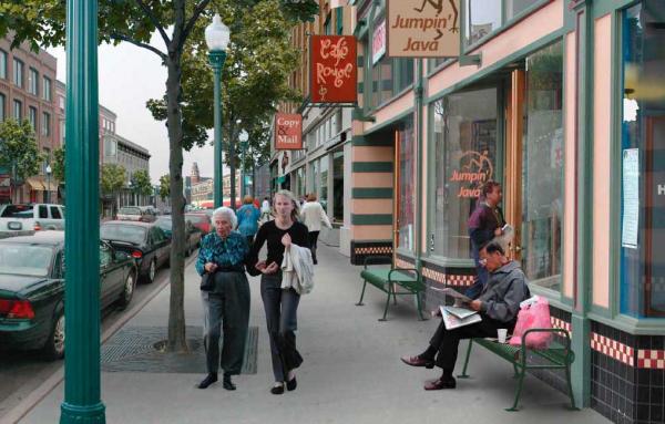
Crabtree: If you apply the Transect, there may be no rainwater treatment in T5 (Urban Center) because you're getting great density and your sustainability is really high in that great density. If you think about it on per capita basis, that's very sustainable, don't do any treatment. Another way is to incorporate it into a community scale— for instance a neighborhood scale treatment area that would allow you to build a great Main Street.
Low: LID approaches stormwater management on a lot-by-lot basis and assumes that each has to be able to mitigate its own stormwater. We use a block-by-block or neighborhood scale approach. We basically look at every surface and every area and determine how all these elements can be combined to invest in public property and the public realm. Design the public right of way areas in a way that actually creates more of a holistic approach. It's more about intercepting the water early on rather than creating a cluster development or a large suburban subdivision. With those types, everything's piped to the edge of the project and there's a huge crater there, which is essentially a single point installation for this subdivision and that's very expensive. Our approach is more point of origination specific, where we intercept and disperse water early on. There's a little saying: "You bring it down, spread it around, and put it in the ground." If you convey it downstream, the water is leaving the community, which may actually need it. It could be part of the reservoir and recharge the groundwater aquifer at the origination point. But I don't think a lot of progress has been made since the recession and people are by default still using the pipe and pond approach to things.
Crabtree: It's a lot like the sprawl paradigm. There's a lot of inertia in that whole system.
Low: But on a positive note I've been invited for a couple of years to CASQA, the California Area Storm Water Quality Association, to talk about place-based design and stormwater management. The entire room, full of civil engineers and regulators, was very receptive of the idea. They're engaging more naturalistic solutions versus quote-unquote engineered solutions.
Can you two talk about the innovative and exemplary projects that employ light imprint/lean infrastructure/green infrastructure as you define it, and describe why they are successful?
Crabtree: There was a competition sponsored by the American Society of Civil Engineers soliciting for a project that was to lay LID over the top of 640 acres in a Houston suburb . How is that sustainable, to be building sprawl and then patch it up with LID? A few of us decided to enter the competition and we broke all the rules by designing a traditional neighborhood development—and in terms of stormwater it handled the entire 640 acres including three schools and it performed better than pre-development .
That was a demonstration project? This was theoretical?
Low: I would call it a counter project.
Crabtree: It could get built. But that wasn’t the way the competition was set up, and that's why we call it Salon des Refuses, because it was a similar thing that was done in Paris where designers were protesting national competitions so they set up their own salon in response to it.
Low: Ultimately, CNU gave an award for it. It was the 2010 Charter Award winner.
Tom, what are projects you would point to?
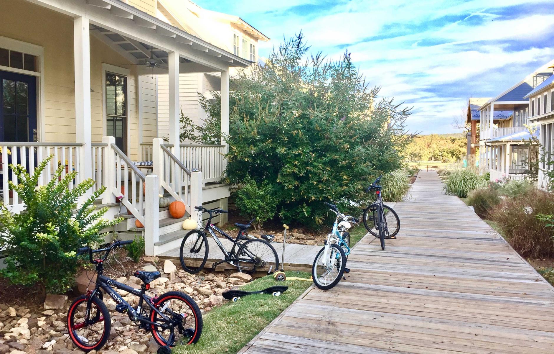
Low: Habersham has been around the longest. It was a pilot project that we were working on at the same time that Light Imprint became an initiative. Habersham is built within a tree canopy. Trees outperform pretty much every other tool imaginable for green infrastructure. We forget that sometimes. More recently, there’s Carlton Landing in Oklahoma, which has a light imprint overlay. The first neighborhood, with over 200 homes, pretty much about the area of Seaside, has been built and it's all done with surface drainage with only a few pipes here and there under the road. It’s another compelling project. Nothing's better than models that demonstrate the ideas.


What are the three most important things that were done Habersham and Carlton Landing, with regard to rainwater? What did you do that people could observe?
Low: In both Habersham and Carlton Landing, there's noticeable surface drainage. You don't see a lot of stormwater inlets because basically every surface possible was made pervious. We're not even talking about really expensive pervious asphalt and concrete, just simple approaches. Instead of fearing stormwater, we call it daylighting and celebrate rainwater so that it is woven into the community as an asset. The streets are laid out with swales. The boardwalks in Carlton Landing use the natural landscape and stone drainage along its edges. It employs a combination of plantings and pervious hardscapes and softscapes. It lies lightly on the land and works with the topography. Water goes where it wants so it must be addressed early on in the design of a project.
Crabtree: Formerly in the Los Angeles metro area, the engineers were very proud of their concrete linings on the rivers and channels, and pave, pipe, and dump was the gold standard. Now they're embarking on a multibillion-dollar project to daylight the river and the channels and start capturing the rainwater. If you think of it as stormwater, it’s a waste product. But rainwater, that’s a resource.

What are the different approaches between the city and the suburbs, or perhaps the different Transect zones?
Low: One of the very first things we did when we were trying to organize all these different tools is to use the Transect as an organizational system. Certain tools work better in certain T-zones (Transect zones), and a good example is that a soft, crushed stone street works really well in, say, T-2 (rural), maybe in T-3 (sub-urban). But when you get into urban centers, you need something that's more durable for things like heavy -duty trucks, moving vans, and fire trucks. Therefore, something like pervious concrete or pervious asphalt might be a better solution, or, like Paul says, in some cases, you're so efficient anyway, maybe there's less of a need-- it's not as important as other places. By organizing categories of paving, channeling, storage, and filtration from rural-to-urban conditions, it allows us to very quickly bring in a lot of tools. There were 60 tools that really worked well, and some work better in certain places than others. They need to be location-specific and climate-specific. We’ve figured out that we can organize tools not only through the Transect, but also according to six variables that have to do with the climate, whether it's hot or cold, or wet or dry, and whether the area is flat or sloping - that makes a difference.
Crabtree: We found that LID regulations, not just the products, were being copied from one region and used in another ineffectively. One region adopted regulations from another that had combined sewer overflows. In other words, when it rained, they were dumping sewage into their rivers as opposed to a separated sewer system. In a combined sewer system, you've got to treat a lot of rain water so that that doesn't happen and it's a whole different paradigm than if you have a separated system, and yet those regulations were being copied. Regulation too needs to be context-sensitive.
Finally, I’d like to talk a little bit about trees. What are your thoughts on how trees are dealt with by specialists today as opposed to how you use trees in a lean or light imprint way?
Low: There’s a street that we retrofitted in Carlton Landing, where it was designed as a main street at 36 feet wide. But compared to everything else, it was really out of scale so we introduced the second alley of trees. Instead of adding bike lanes, I suggested adding tree lanes, which basically entails planting trees wherever there is parallel parking. That doubles the tree canopy, not just the median. Based on the metrics of trees, including the benefits of shade, I would argue that planting trees is one of the easiest things you can do that provides the greatest benefit.
Crabtree: In studying the history of engineering in the US, there’s a brief period before World War II when planners and designers indicated exactly where the trees should be along a street. Almost all of the public works standards now do not include street trees in their standard street section. They're not prohibiting them but they don’t make them an option, so no one leaves any room for a tree root zones and if they are planted then they suffer.
Note: CNU intern Benjamin Crowther helped to produce this interview and article.


