I-375 is a 1.06-mile spur that pierces Detroit's downtown. Begun in 1959, this 4-lane, below-grade freeway disconnected Detroit's Riverfront, Greektown, Eastern Market, and Stadium districts. Its legacy is tied to failed urban renewal efforts that destroyed thriving black neighborhoods known for their thriving nightlife in the early 1900's from its abundant jazz and blues nightclubs. One of these jazz clubs, called Paradise Theatre, has been renovated into Orchestra Hall. According to the U.S. Census, Detroit's population shrunk from a high of around 2 million people in 1959 to a population of about 700,000 today. Additionally, according to Michigan Department of Transportation (MDOT), the vehicle usage of I-375 has shifted markedly. Since 2009, annual daily travel averages have decreased more than 13% from 14,112 and 53,900 vehicles at the Jefferson and I-75 segments to 17,101 and 41,512 today.
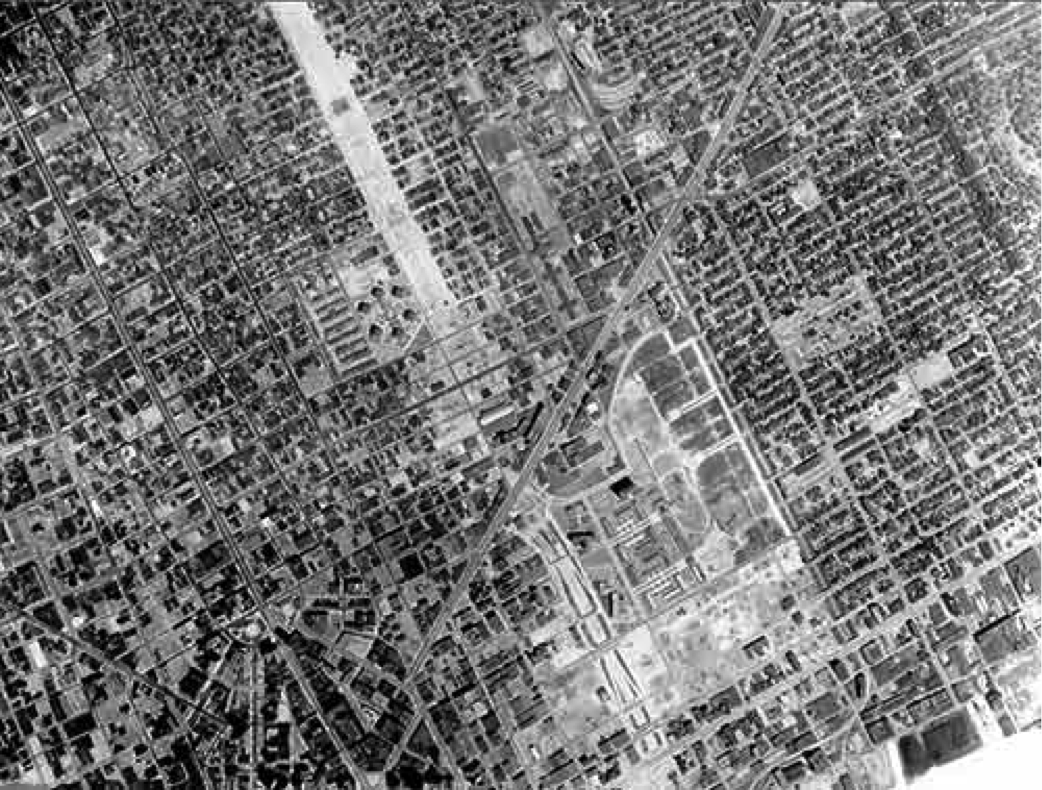
A view of I-375 being constructed in 1967.
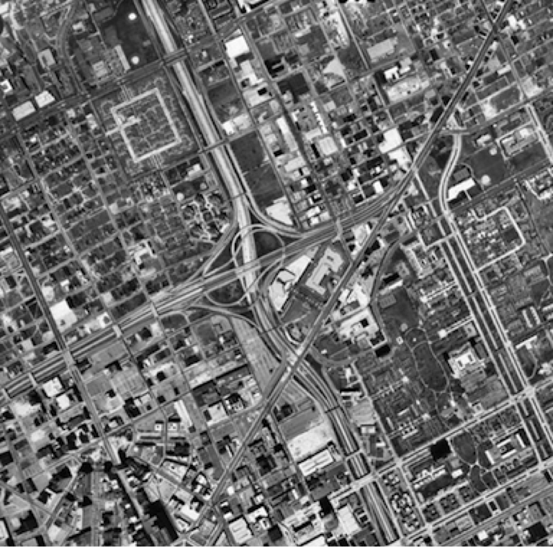
I-375 completed in 1997.
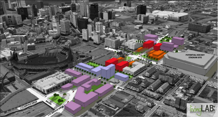
Detroit is facing a number of growing challenges, including the dramatic loss of its tax base over the past four decades. With the public unraveling of the City's financial woes, namely its $18.5 billion bankruptcy, the City is in the midst of a critical overhaul effort. This effort is guided by a comprehensive economic development plan called Detroit Future City, which calls for smarter land use planning and economic incentives. Many advocates and policy officials agree that the removal of I-375 would fit into this plan if turned into a boulevard. MDOT Director Kirk Steudle is open to study this alternative and has stated that such a project could open up about 12 acres for development.
CNU supports the growing community of voices around removing the I-375. The business community would stand to gain from the increase in foot traffic, and a boulevard would connect Detroit's fastest growing neighborhoods and allow citizens to engage with the Riverfront more easily. Lastly, the city would be removing an eyesore from its downtown landscape and an opportunity to turn a page into a new era of transportation planning that fits in with its bicycle, rapid transit, and new light rail infrastructure.
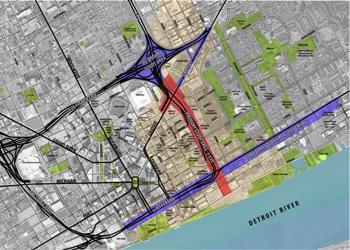
Study-areas to determine re-use of interstate corridors.
In December 2013, Detroit's Downtown Development Authority moved forward with a planning contract to study six alternatives for I-375 from Gratiot Avenue to Atwater Street. These range from reparing or replacing the existing structure to putting a walkable boulevard in its place, with prices between $40 million and $80 million. The plan is precipitated by local organizations like the Detroit RiverFront Conservancy who suggests that Detroit follow the national trend in urban freeway removal and convert I-375 into an at-grade, pedestrian friendly thoroughfare.
Update as of July 2016:
A recommendation on what to do with Detroit's aging I-375 expressway-- originally expected more than a year ago-- has been delayed indefinitely due to a lack of consensus and money. Despite this setback, the City of Detroit remains open to the idea of removing I-375. Senior project manager with the Michigan Department of Transportation Kelby Wallace has said that a total of six options outlined two years ago remain on the table, and those include rebuilding I-375 as is as a below-grade expressway or replacing it with a surface street that would connect better with the rapidly redeveloping east riverfront district.
Proposed redevelopment of _375 as boulevard with infill.
Top photos: Detroit, 1951 and 2010. Source: The Institute for Quality Communities - University of OklahomaBe sure to follow the project's website to keep up to date with Detroit's I-375 project.

